External Landform Processes and Related Features
Senior 6 · Geography
External Landform Processes and Related Features
Lesson 4 of 5
25 min
Roughly 260 km north of Kigali, the Rwenzori mountains rise to 5,109 m, and their highest peaks carry glaciers within a degree of the equator. Glaciers are rare in Africa today, found only on the Rwenzori, Mount Kenya and Kilimanjaro, and they are shrinking. Yet ice still covers about a tenth of the world's land. During the ice ages it covered far more, and in doing so it carved deep valleys and spread the deposits beneath many fertile plains of Europe and North America. This lesson explains how glaciers form and move, the landforms they create, and what they mean for people.
Definition
Glacier: a large mass of ice, formed from compacted snow, that moves slowly downhill or outwards under its own weight.
Where more snow falls in winter than melts in summer, the snow builds up year after year. Its weight squeezes out the air: fluffy snow turns to granular firn (névé), and over years to centuries to solid glacier ice, with a density of about 917 kg m⁻³. When the ice is thick enough, a few tens of metres, it begins to flow.
Figure 7: the long profile of a valley glacier.
Definition
Accumulation: gain of ice by snowfall, avalanches and refreezing. Ablation: loss of ice by melting, evaporation and the breaking off of ice. The equilibrium line separates the upper zone where accumulation exceeds ablation from the lower zone where ablation exceeds accumulation. The mass balance is total accumulation minus total ablation over a year: a negative balance means the glacier is thinning and usually retreating.
Worked example 1: mass balance
Problem. Over a year a glacier gains the equivalent of 1.8 m of water by accumulation and loses 2.4 m by ablation. If this continues for 20 years, how much ice thickness is lost? Water has a density of 1,000 kg m⁻³ and ice 917 kg m⁻³.
Solution.
Ice is less dense than water, so the thickness of ice lost is greater than the depth of water it would make.
Most glaciers move a few centimetres to a few metres a day. In a cirque the ice moves in a curve, rotating as it flows out of the hollow, which helps to deepen it. Where the bed steepens, the brittle surface ice cracks into crevasses.
Worked example 2: measuring flow
Problem. A stake drilled into a glacier moves 45 m in 90 days. Find its speed in metres per day and per year.
Solution. m per day; , about 180 m per year. A stake near the valley side would move more slowly, because of friction with the valley walls.
Glaciers erode mainly by plucking (meltwater freezes onto jointed rock and the moving ice tears blocks away) and abrasion (rock fragments frozen into the base of the ice scrape the bed like sandpaper, leaving scratches called striations). Freeze–thaw on the exposed valley walls supplies more debris.
Figure 8: a river valley and a glacial trough in cross-section, and a plan of cirques around a peak.
| Landform | Description and formation |
|---|---|
| Cirque (corrie) | An armchair-shaped hollow with a steep back wall, deepened by rotational flow, plucking and abrasion; often holds a small lake, a tarn |
| Arête | A knife-edge ridge between two cirques or valleys cut back towards each other |
| Pyramidal peak (horn) | A sharp peak left where three or more cirques have eroded back into a mountain |
| Glacial trough | A U-shaped valley: a river valley widened and deepened by ice, with steep sides and a flat floor |
| Truncated spur | A spur of the old river valley cut off by the ice, leaving a cliff |
| Hanging valley | A tributary valley left high above the main trough because its small glacier eroded less; its stream falls as a waterfall |
| Ribbon lake | A long lake in a part of the trough that the ice over-deepened |
| Roche moutonnée | A rock mound smoothed by abrasion on the up-ice side and made jagged by plucking on the down-ice side |
| Fjord | A glacial trough drowned by the sea after the ice melted |

Material carried and dropped by ice is till (boulder clay): an unsorted mixture of clay, sand, stones and boulders, with angular stones because ice does not round them. Meltwater, in contrast, sorts its load by size and rounds it, producing fluvioglacial deposits of sand and gravel.
Figure 9: deposits in front of a retreating glacier.
| Landform | Description and formation |
|---|---|
| Lateral moraine | A ridge of till along the side of a valley glacier, much of it from rockfall off the valley walls |
| Medial moraine | A ridge down the middle of a glacier where two lateral moraines join as two glaciers meet |
| Terminal moraine | A ridge across the valley marking the furthest advance of the ice |
| Recessional moraine | A ridge left where the snout paused during retreat |
| Drumlin | A smooth, egg-shaped hill of till moulded under moving ice, with its blunt end facing up-ice |
| Erratic | A boulder carried far from its source and dropped on different rock |
| Esker | A long, winding ridge of sand and gravel laid down by a meltwater stream in a tunnel under the ice |
| Outwash plain (sandur) | A spread of sorted sand and gravel beyond the ice, laid down by meltwater |
| Kettle hole | A hollow, often a lake, left where a buried block of ice melted |

In 1906 the Rwenzori held forty-three named glaciers on six mountains, covering about 7.5 km². By 2005 fewer than half remained, on only three mountains, covering about 1.5 km². On Kilimanjaro, almost 85% of the ice cover disappeared between 1912 and 2011. Studies attribute the Rwenzori's losses mainly to rising temperatures linked to global climate change. Rwanda has no glaciers, but the old moraines and glacial valleys on the Rwenzori and Mount Kenya show that the ice once reached much further down the mountains.

Worked example 3: the Rwenzori's retreat
Problem. Using the figures above, find the percentage of the Rwenzori's glacier area lost between 1906 and 2005, and the average loss per year.
Solution.
An average hides the trend: studies of tropical glaciers suggest the loss has not been even over the century, so a straight-line forecast of when the ice will vanish is only a rough guide.
| Opportunities | Problems |
|---|---|
| Hanging valleys and ribbon lakes suit hydroelectric power and water storage | Steep slopes and thin, stony soils limit farming in glaciated uplands |
| Glaciers and snowfields feed rivers in the dry season | Avalanches, rockfalls and floods from melting ice or burst glacial lakes |
| Spectacular scenery attracts tourists and climbers (the Rwenzori, Kilimanjaro) | Shrinking glaciers threaten water supplies and tourism |
| Till and outwash give fertile soils, sand and gravel on lowlands | Poorly drained till and kettle holes leave marshy ground |
| Fjords give deep, sheltered harbours; troughs provide routes through mountains | Communication is hard across steep arêtes and deep troughs |
Warning
Common mistakes
Tip
Exam technique. Explain an erosional landform in three steps: the starting point (a hollow, a river valley), the processes (plucking, abrasion, freeze–thaw, rotational flow) and the result after the ice melts. Draw a labelled before-and-after sketch where you can.
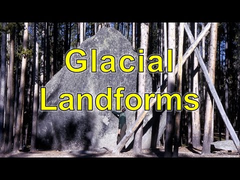
GeoScience Videos: "Glacial Landforms". A review of the landforms of glacial erosion (cirques, arêtes, striations, U-shaped valleys, fjords) and deposition (till and moraines). Tick off each landform in the two tables as it appears.
Practice
Summary
Sources and credits
Figures 7 to 9, the worked examples and the exercises were drawn and written by Ganzaa. The distance from Kigali to the Rwenzori was measured by Ganzaa from the coordinates of the two places.
Video: "Glacial Landforms", GeoScience Videos, embedded from YouTube.
This lesson adapts CC BY-SA material and is shared under CC BY-SA 4.0.