Vegetation of Africa and the World
Senior 3 · Geography
Vegetation of Africa and the World
Lesson 3 of 4
25 min
Let's begin
In 2002 Gishwati Forest, in the west of Rwanda, had shrunk to about 6 km², a small fraction of the forest that once covered the area. Twenty years later it is part of a national park and a UNESCO biosphere reserve, and chimpanzees still live in it. Rwanda is small, but in a few hours' drive it holds three of the vegetation types you met in Lesson 1: montane rainforest, the forests and heaths of high volcanoes, and savanna with papyrus wetlands. This lesson studies them through the country's four national parks.
Rwanda's vegetation follows its relief (Unit 2) and climate (Unit 4).
Today most of Rwanda is farmland, and much of its tree cover is planted woodlots, often of eucalyptus, an Australian tree. Natural vegetation survives mainly in the protected areas shown in Figure 4.
Figure 4: Rwanda's four national parks. Drawn by Ganzaa; park outlines are simplified.
Definition
Montane forest: forest of high mountains in the tropics, cooler and often misty, with tree ferns, mosses and epiphytes. Example: Nyungwe. National park: a large area protected by law for its nature and landscape, where farming, hunting and settlement are not allowed. Rwanda has four.
| Park | Where | Area and status (source, year) | Natural vegetation |
|---|---|---|---|
| Nyungwe | South-west, on the Congo–Nile ridge | 101,900 ha (1,019 km²); a reserve from 1933 and a national park from 2005; a UNESCO World Heritage Site since 2023 (RDB, 2023) | Montane rainforest: "the largest block of natural forest in the region" (RDB, 2023) |
| Volcanoes | North-west, on the slopes of the Virunga volcanoes | To be enlarged by about 23%, or 37.4 km² (RDB, 2021); part of a UNESCO biosphere reserve since 1983 (RDB, 2020) | Montane forest, bamboo forest, open grassland, swamp and heath (Visit Rwanda, RDB) |
| Gishwati-Mukura | West, two separate forests on the Congo–Nile ridge | 34 km² plus a buffer zone (Visit Rwanda, RDB); gazetted in 2016 as the fourth national park; a UNESCO biosphere reserve from 2020 (RDB, 2020) | Montane forest of about 60 tree species, including indigenous hardwoods and bamboo (Visit Rwanda, RDB) |
| Akagera | East, along the Tanzanian border | 1,122 km² (RDB, 2025); managed by RDB with African Parks since 2010 | Savanna, woodland, wetland and about a dozen lakes; "the last remaining refuge for savannah adapted species in Rwanda" (RDB, 2025) |
Nyungwe is a rainforest, but a mountain one. Because it is high, it is cooler than the Congo Basin, and cloud often lies on the ridges. Tree ferns, mosses and orchids grow on the trunks, and the forest is layered like a lowland rainforest. RDB (2023) records over a dozen primate species, 322 bird species, 200 identified orchids and nearly 300 butterfly species, several of them found nowhere else.

On the Virunga volcanoes the vegetation changes with height, as on Kilimanjaro in Unit 2. Above the farmland at the foot of the mountains comes dense bamboo forest, at about 2,500–3,200 m; then, mainly on the wetter slopes, a forest of hagenia and hypericum trees draped in moss, at about 2,600–3,600 m; then giant lobelias, heath, grassland and swamp from about 3,500 m; and near the summit of Karisimbi (4,507 m) only hardy alpine plants survive the night frosts. (Heights from Wikipedia's article on the park; RDB lists the same belts: evergreen and bamboo forest, open grassland, swamp and heath.) Mountain gorillas feed on the bamboo shoots and the leafy plants of these forests.

Gishwati is the clearest Rwandan example of how fast people can remove natural vegetation, and how it can be restored. According to RDB (2020), Gishwati Forest was reduced from about 700 km² in the 1930s to 6 km² in 2002. Visit Rwanda (RDB) names the causes: resettlement, illegal mining in the mineral-rich forest, and livestock farming. Without the forest, the steep slopes are exposed to soil erosion and landslides. The forest has since been replanted and protected, through a project implemented by the Rwanda Environment Management Authority (REMA), and the park was gazetted in 2016.
Akagera is Rwanda's savanna. Open grassland with scattered acacias covers the hills; woodland grows in the valleys; and along the Akagera river lie papyrus swamps and lakes such as Ihema. RDB (2025) calls it Central Africa's largest protected wetland. Fire and grazing by buffalo, zebra and other animals keep the grassland open.

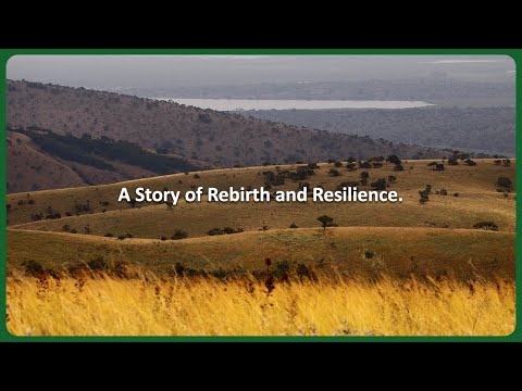
African Parks, which manages Akagera with RDB: Akagera National Park, Rwanda. Watch for the landscape rather than the animals: open grassland, wooded hills, lakes and papyrus wetland, all in one park.
Definition
Biosphere reserve: an area recognised by UNESCO where nature is protected in a core zone while people live and work sustainably around it. Buffer zone: a strip of land around a protected area where only activities that do not harm it are allowed, e.g. tree planting or beekeeping. Example: the buffer zone around Gishwati-Mukura.
Worked example
Worked example 1: how much of Gishwati was lost? Using RDB's figures (2020), calculate the percentage of Gishwati Forest lost between the 1930s and 2002.
Worked example
Worked example 2: the size of Volcanoes National Park. RDB (2021) said the planned extension, 37.4 km², would enlarge the park by about 23%. Estimate the park's size before and after.
Warning
A tree is not a forest. Rwanda's hills carry many trees, but most are planted eucalyptus, pine or grevillea in woodlots, or fruit and shade trees on farms. These are not natural vegetation. When a question asks for Rwanda's natural vegetation, describe montane forest, bamboo, savanna and papyrus swamp, not eucalyptus.
Tip
West wet and wooded, east dry and grassy. Learn the four parks in a loop starting at the top left: Volcanoes (volcano belts), Gishwati-Mukura (restored forest), Nyungwe (montane rainforest), Akagera (savanna and wetland).
Practice
Sources and credits
This lesson adapts CC BY-SA material and is shared under CC BY-SA 4.0.