Formation of Relief Features in Rwanda
Senior 4 · Geography
Formation of Relief Features in Rwanda
Lesson 3 of 5
25 min
From Musanze, the skyline to the north is a row of mountains with smooth, steep, almost perfectly conical sides. They are volcanoes of the Virunga range, which straddles Rwanda, the DR Congo and Uganda. REMA counts eight major volcanoes in the range, five of them in Rwanda's Volcanoes National Park: Karisimbi, Bisoke, Sabyinyo, Gahinga and Muhabura. Karisimbi, at 4,507 m, is the country's highest point (REMA, State of Environment and Outlook Report, 2021).

Definition
Volcanicity (vulcanicity): all the processes by which molten rock (magma) and gases rise from inside the earth towards or onto the surface. Magma that reaches the surface is called lava.
A volcano is active if it has erupted in recent times and may erupt again, dormant if it has not erupted for a long time but could, and extinct if it is not expected to erupt again. Example: Nyiragongo, just across the border in the DR Congo, is active; it erupted in January 2002 and in May 2021 (REMA).
The Virunga volcanoes stand on the western branch of the East African Rift. Where the crust is stretched and broken by faults, magma can rise along the fractures. That is why Rwanda's volcanoes, its hot springs and its earthquakes are all found in the west, along the rift, while the old rocks of the east have none.
Figure 4: volcanic landforms of the kind found in north-western Rwanda (a simplified sketch).
| Landform | How it forms | Rwandan example |
|---|---|---|
| Composite cone | Layers of lava and ash from many eruptions build a steep cone around the vent | Karisimbi, Muhabura, Gahinga, Sabyinyo, Bisoke |
| Crater and crater lake | A hollow at the summit vent fills with rain water | The crater lake on Bisoke (RDB) |
| Lava plain | Fluid lava spreads over low ground and solidifies | Old lava flows in the north-west (REMA) |
| Lava-dammed lake | A lava flow blocks a river valley; water collects behind the dam | Lakes Burera and Ruhondo |
| Lava-tube cave | The surface of a lava flow cools and hardens while molten lava drains out beneath it | The Musanze caves, which RDB describes as formed by volcanic eruptions |
| Hot spring | Ground water heated at depth rises along faults | Hot springs along the Lake Kivu belt (REMA) |

Worked example 1: the step between two lava-dammed lakes
Data. Lake Ruhondo receives its water from Lake Burera, and the two lakes are separated by a strip of land about 1 km wide (Wikipedia, "Lake Ruhondo"). The SRTM elevation data give lake surfaces of about 1,860 m for Burera and 1,762 m for Ruhondo.
Problem. Find the fall in level and the average gradient of the ground between the lakes.
Solution.
The lava dams left Burera "perched" about 100 m above Ruhondo. REMA notes that the water falling from Burera into Ruhondo drives the Ntaruka hydroelectric power station (REMA, 2021): a volcanic landform turned into a resource.

An earthquake is a sudden shaking of the ground caused by the release of energy when rocks break and move along a fault. REMA explains that Rwanda lies in a tectonic region whose earthquakes centre on Lake Kivu, so the west of the country is the most exposed.
Figure 5: the focus is where the rocks break; the epicentre is the point on the surface directly above it.
Definition
Focus (hypocentre): the point underground where the rocks first break. Epicentre: the point on the surface directly above the focus. Seismic waves: the vibrations that spread out from the focus.
Magnitude: a measure of the energy released, on a logarithmic scale: each whole number up means about 10 times more ground movement and about 32 times more energy.
On 3 and 14 February 2008 two earthquakes, of magnitude 6.1 and 5.0, struck with their epicentres close to Bukavu in the DR Congo, at the southern end of Lake Kivu. In Rwanda, Rusizi and Nyamasheke districts were seriously affected: 37 people died and 643 were injured, 1,201 families lost their homes, 20 primary and 4 secondary schools were damaged, and the hospital of Bushenge was badly affected (REMA, 2009, citing OCHA).
Earthquakes leave landforms too: fault scarps (steep steps where one block has moved up against another), cracks and fissures in the ground, and landslides shaken loose from steep, wet slopes.
Worked example 2: comparing two earthquakes
Problem. How much more ground movement and how much more energy did the magnitude 6.1 earthquake of 3 February 2008 have than the magnitude 5.0 one of 14 February?
Solution. The difference in magnitude is .
The first earthquake released about 45 times as much energy as the second, though its magnitude was only 1.1 higher.
| Positive | Negative |
|---|---|
| Fertile volcanic soils: REMA notes that the farming population near the Volcanoes National Park is among the densest in the country | Eruptions of Nyiragongo threaten Goma and Rubavu; in January 2002 up to 400,000 people fled from Goma into Rwanda near Gisenyi (REMA, citing IFRC) |
| Tourism: gorilla trekking, volcano climbs, the Bisoke crater lake, caves | Earthquakes destroy houses, schools and roads, as in Rusizi and Nyamasheke in 2008 |
| Geothermal energy: hot springs along the Lake Kivu belt, with an estimated potential of 170–320 MW (REMA, 2009) | Gas dissolved in Lake Kivu could be released by volcanic activity; after the May 2021 eruption, REMA's monitoring found no imminent risk of a gas outburst |
| Building stone and lava aggregate; lava-dammed lakes used for hydroelectricity (Ntaruka) | Steep volcanic slopes are prone to landslides and soil erosion |
Warning
Magnitude is not damage. A moderate earthquake can kill more people than a stronger one if it strikes near towns with weak buildings, on steep wet slopes, or at night. The effects of the 2008 earthquakes in Rusizi and Nyamasheke came as much from the buildings and slopes as from the magnitude.
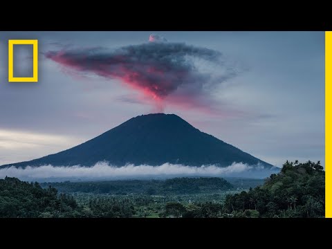
National Geographic: "Volcanoes 101". The main types of volcano and how eruptions happen. As you watch, decide which type the Virunga cones belong to, and why.
Practice
Key points
Sources and credits
Sources: Rwanda State of Environment and Outlook Report, REMA, 2009 (2008 earthquakes, Nyiragongo 2002, geothermal potential, volcanic soils); Rwanda State of Environment and Outlook Report 2021, REMA (the Virunga volcanoes, Ntaruka, Lake Kivu monitoring); Volcanoes National Park, Rwanda Development Board (Bisoke crater lake); Lake Ruhondo, Wikipedia contributors, CC BY-SA 4.0, adapted by Ganzaa (lava damming). Lake levels: NASA SRTM data via OpenTopoData.
Photos: Muhabura na gahinga and Lake burera 07082024, Rogerirakoze, CC BY-SA 4.0; Bisoke Crater Lake in Volcanoes National Park, Rwanda, Happy Gentille, CC0; via Wikimedia Commons.
Figures 4 and 5, the worked examples and the exercises were drawn and written by Ganzaa.
Video: "Volcanoes 101", National Geographic, embedded from YouTube.
This lesson adapts CC BY-SA material and is shared under CC BY-SA 4.0.
Quick check
Which landform was formed when a lava flow blocked a river valley?