Population and Settlement
Senior 1 · Geography
Population and Settlement
Lesson 4 of 5
22 min
Figure 1 shows three imaginary rural areas from above. In each, count the houses and decide how far a family would walk to fetch water, reach school or visit a neighbour. Which pattern is cheapest to supply with electricity? Which gives each family its fields right next to the house?
Figure 1. Three patterns of rural settlement. Sketch maps drawn by Ganzaa, not to scale.
Definition
Rural settlement: a settlement in the countryside, where most people earn their living from farming, livestock, fishing or forestry, and houses are fairly far apart. Example: a village of farming families in Gisagara District.
Definition
Urban settlement: a town or city, where many people live close together and most work in industry, trade and services rather than farming. Example: Kigali; the secondary cities such as Huye, Musanze and Rubavu.
Definition
Settlement pattern: the way houses are arranged on the land, seen from above. Example: the nucleated, linear and dispersed patterns in Figure 1.
| Feature | Rural settlement | Urban settlement |
|---|---|---|
| Size and density | Small; houses spread out | Large; buildings close together, often several storeys high |
| Main work | Farming, livestock, fishing, forestry | Trade, industry, transport, offices, services |
| Services | Few: a primary school, a health post, a water point | Many: hospitals, universities, banks, markets, piped water, electricity |
| Share of Rwandans (2022) | 72.1% (9,545,149 people) | 27.9% (3,701,245 people) |
Source: NISR, Census 2022, Table 2.
Worked example 1: how urban is Rwanda?
In 2022, 3,701,245 of Rwanda's 13,246,394 people lived in urban areas, 1,517,168 of them in the City of Kigali. (a) What percentage of Rwandans were urban? (b) What share of the urban population lived in Kigali?
Answer. (a) About 28%: nearly three Rwandans in four still live in rural areas. (b) About 41% of all town dwellers live in Kigali, so Kigali is by far the largest town. A city that is much larger than any other in its country is called a primate city.

| Pattern | What it looks like | Why it forms | Advantages | Disadvantages |
|---|---|---|---|---|
| Nucleated (clustered) | Houses grouped closely around a centre: a crossroads, a market, a water point | Shared water or services; safety; planning (the imidugudu) | Cheap to supply with water, power and roads; neighbours close for help | Fields may be far away; less space for animals and gardens |
| Linear | Houses in a line along a road, a ridge, a river or a lake shore | Access to transport and trade; narrow valley floors or ridges | Easy transport; shops and trade by the road | Long distances from one end to the other; traffic danger |
| Dispersed (scattered) | Single homesteads spread over the land, each among its own fields | Each family living on its farm; plentiful land; hilly relief | Farm close to the house; privacy; easy to watch crops and animals | Services very costly to provide; isolation; wastes farmland on houses and paths |
Definition
Umudugudu (plural imidugudu): a village: both the smallest administrative unit in Rwanda and a planned, grouped (nucleated) rural settlement. Example: Rwanda has more than 14,000 imidugudu, each with, on average, a little over 200 households.

Important
Case study: the imidugudu policy
Traditionally most rural Rwandans lived in dispersed homesteads, each family in the middle of its own fields on the hillside. On 13 December 1996 the Cabinet decided to group the rural population into planned villages, the imidugudu. The reasons were:
Today there are more than 14,000 imidugudu, and moving families from high-risk zones into planned villages is still part of disaster prevention (Unit 11). The policy has also been criticised: in the early years some families were moved against their will (Human Rights Watch reported this in 2001), some villages were built far from people's fields, and there is less room near the house for animals. A fair judgement weighs both sides.
Worked example 2: why grouping saves money
A water company must lay pipes to 100 families. If the homesteads are dispersed about 300 m apart, it needs about 30 km of pipe; if the same families live in a nucleated umudugudu with houses about 20 m apart along its streets, it needs about 2 km. How many times less pipe does the village need?
Answer. About 15 times less pipe, and the same saving applies to electricity lines and roads. (The distances are simplified for the example, but the idea is the main economic argument for nucleated settlement.)
Warning
Pattern is not size. A nucleated village can be small, and a dispersed area can hold many people. The pattern describes how houses are arranged, not how many there are. And "linear" means along a line feature (road, river, ridge, shore), not simply "in a row" on a map by chance.
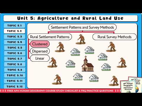
Clustered, Dispersed and Linear Rural Settlement Patterns, by Mr Carter's Human Geography Class (2 min). Match each pattern he describes to a panel of Figure 1.
A family's fields are 3 km from their new umudugudu. List two ways in which their life is easier and two ways it is harder than when they lived in a dispersed homestead. On balance, which pattern would you choose, and why?
Tip
N-L-D: Nucleated = a nest of houses; Linear = a line along a road; Dispersed = dots scattered over the hills. For each, name it, describe it, and give one reason it formed there.
Practice
Remember
Sources and credits
The lesson text, sketch maps, tables, worked examples and practice are written by Ganzaa.
This lesson adapts CC BY-SA material and is shared under CC BY-SA 4.0.