Egyptian Civilization
Senior 1 · History and Citizenship
Egyptian Civilization
Lesson 2 of 5
25 min
Study the map. The green strip is the only land where crops could grow; everything beige is desert. Then read what the Greek historian Herodotus wrote after visiting Egypt about 450 BCE.
"For even if a man has not heard it before, he can readily see, if he has sense, that that Egypt to which the Greeks sail is land deposited for the Egyptians, the river's gift."
Herodotus, The Histories, book 2, chapter 5, translated by A. D. Godley (1920). Public domain.
Why did Herodotus call Egypt "the river's gift"? Use the map to explain in one sentence.
Almost no rain falls in most of Egypt. Every year, however, the summer rains in the Ethiopian highlands swelled the Blue Nile, and from about July the river rose and spread over the valley floor. When the water went down in autumn, it left a layer of rich black mud (silt). Farmers sowed wheat, barley and flax in the wet soil and harvested them in spring. The Egyptians called their land Kemet, "the black land", after this soil, and the desert Deshret, "the red land".
| Season | Months (approximately) | What happened |
|---|---|---|
| Akhet (flood) | July to October | the Nile covered the fields; farmers worked for the state, for example on building projects |
| Peret (growing) | November to February | fields ploughed and sown; crops watered from canals |
| Shemu (harvest) | March to June | crops harvested and stored; scribes measured the harvest for tax |

Definition
Irrigation: bringing water to crops by artificial means such as canals, ditches and water-lifting devices. Example: Egyptian farmers dug canals and built earth banks to trap floodwater in basins.
Definition
Shaduf: a water-lifting device: a long pole balanced on a post, with a bucket at one end and a heavy weight at the other, used to raise water from the river or a canal to the fields.
Definition
Delta: a flat, fan-shaped area of land formed where a river drops its silt as it enters the sea. Example: the Nile delta, which formed Lower Egypt.
Definition
Cataract: a stretch of rapids where rocks break the surface of a river, making boat travel difficult. Example: the First Cataract at Aswan, Egypt's traditional southern border.

Worked example: what does the Narmer Palette tell us?
The White Nile, which carries water all year round, begins in the Great Lakes region. Rwanda's Nyabarongo River, fed by the Akanyaru and other streams, flows on as the Akagera (Kagera) into Lake Victoria, from which the Nile leaves at Jinja in Uganda. In 1898 the German explorer Richard Kandt traced one of the Nile's most distant headwaters to the Nyungwe forest in south-western Rwanda. Every drop that falls in much of Rwanda may one day pass the pyramids of Giza.
The flood that made Egyptian farming possible, however, came mainly from the Blue Nile and the Ethiopian highlands. The two rivers meet at Khartoum. Today the countries of the Nile basin, including Rwanda, still negotiate how to share the river's water.
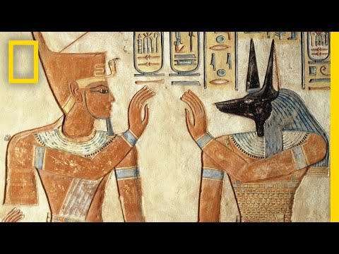
National Geographic: "Ancient Egypt 101". Watch for how the Nile shaped Egyptian farming and beliefs, and compare what the video says with the six factors above.
Class debate: "Without the Nile there would have been no Egyptian civilisation." Do you agree completely? Use at least two factors from the list that are about people rather than geography.
Practice
Sources and credits