Wave Erosion and Deposition
Senior 6 · Geography
Wave Erosion and Deposition
Lesson 3 of 5
25 min
Namibia has more than 1,500 km of Atlantic coastline, much of it open beach battered by heavy surf. Yet the country's main port, Walvis Bay, has calm water, because a long finger of sand called Pelican Point curls round the bay and shelters it from the ocean swell. Pelican Point is a spit, built grain by grain by waves carrying sand northwards along the coast, and it gives Namibia its only natural deep-water harbour. Depositional landforms like this are among the most useful features of any coast, and also among the most changeable. This lesson explains how beaches, spits, bars and tombolos form, and why people must manage them with care.
Definition
Beach: an accumulation of sand, shingle or pebbles on the shore, between the lowest tides and the highest point reached by storm waves.
Berm: a low ridge on a beach built at the limit of the swash, often one for each recent high tide. Storm ridge: the highest ridge on a beach, of the coarsest material, thrown up by storm waves.
Sediment cell: a stretch of coast, usually between two large headlands, within which sediment moves around but which gains or loses little sediment to the next cell. The sediment budget is the balance between the sediment entering and leaving it.
Waves deposit where they lose energy, so beaches form where sediment is plentiful (from rivers, eroding cliffs and the seabed) and where constructive waves dominate, as in sheltered bays. The beach material decides the slope:
A typical beach profile, from the land, has a storm ridge of large pebbles at the back, one or more berms marking recent high tides, and, on wide sandy beaches, ridges and runnels parallel to the shore on the lower beach. Where waves arrive parallel to the shore, as in a bay, the beach is swash-aligned and sediment moves mainly up and down it; where they arrive at an angle, the beach is drift-aligned and sediment moves along it by longshore drift. On Lake Kivu, the sandy beaches at Rubavu are swash-aligned beaches of this kind, built by the lake's own wind waves.
Worked example 1: a sediment budget
Problem. A sediment cell (illustrative figures) receives each year 45,000 m³ of sediment from eroding cliffs, 15,000 m³ from a river and 5,000 m³ washed in from the seabed. It loses 52,000 m³ to longshore drift leaving the cell, 10,000 m³ to deep water offshore and 8,000 m³ to sand mining. (a) Find the annual budget. (b) If the loss is spread over a beach 4 km long and 60 m wide, by how much does the beach surface fall each year? (c) Evaluate a ban on sand mining.
Solution. (a) Inputs ; outputs . Budget : a deficit, so the beach is shrinking.
(b) Beach area .
(c) Without mining the budget becomes , a small surplus, so the beach would slowly build up instead of lowering. The ban tackles the only output people control directly, but the surplus is small: if a dam upstream cut the river's 15,000 m³, the cell would be in deficit again.
Definition
Spit: a long, narrow ridge of sand or shingle joined to the land at one end and ending in open water at the other, built by longshore drift where the coast changes direction. A spit whose end curves landward is a recurved spit.
Salt marsh: an area of mud colonised by salt-tolerant plants, which forms in sheltered, shallow water such as behind a spit.
Figure 8: the formation of a spit across an estuary.
Spurn, at the mouth of the Humber estuary in England, is a well-studied example: a sand spit about 5 km long. After a tidal surge in December 2013 broke through its narrow neck, the sea now covers that neck at high tide, so Spurn has become a tidal island. Spits are not permanent: they are built, breached and rebuilt as the balance between drift and storms changes.

Worked example 2: will the spit close the estuary?
Problem. Old maps show that a spit has grown 1.1 km across an estuary in 220 years (illustrative figures). The estuary mouth is 1.8 km wide. At the same rate, how long would the spit take to reach the far bank? Is it likely to?
Solution.
It is unlikely to close. As the gap narrows, the river and the tidal currents are squeezed through a smaller opening and flow faster, scouring the channel and carrying sediment away. Growth slows as the gap closes, and a channel stays open unless the river is very small.
Definition
Bar (bay bar): a ridge of sand or shingle that has grown right across a bay or river mouth, joining two headlands. Lagoon: the body of shallow, calm water cut off behind a bar.
Tombolo: a ridge of sand or shingle joining an island to the mainland. Cuspate foreland: a triangular projection of the coast, built where two sets of drift meet.
Barrier beach (barrier island when broken into islands): a long ridge of sand or shingle running parallel to the coast, separated from it by a lagoon or marsh.
Figure 9: (A) a bay bar and its lagoon; (B) a tombolo.
A bar forms when a spit grows right across a bay where no strong river flows to keep a gap open, sealing off a lagoon. Slapton Sands in Devon, England, is a shingle bar that separates the freshwater lake of Slapton Ley from the sea. Along the coast of Ghana, Keta Lagoon is separated from the Gulf of Guinea by a narrow sandbar. Some bars began as offshore ridges of sediment that were pushed landward as sea level rose after the last ice age.
A tombolo forms where an island lies close to the shore. Waves bend round both sides of the island, lose energy in its shelter and deposit sand behind it, until a ridge connects the island to the mainland. The ridge joining St Ninian's Isle to Mainland Shetland, Scotland, is about 500 m long and is the largest tombolo in the United Kingdom. Not every ridge that reaches an island is a tombolo, however: Chesil Beach in Dorset is often called one, but research shows it is a barrier beach that has been pushed landward.
Where two drifts from different directions meet, they may build a triangular cuspate foreland, such as the shingle headland of Dungeness in Kent, England.


| Landform | Opportunities | Problems |
|---|---|---|
| Beaches | Tourism and recreation, fish landing sites, sand for building; a beach absorbs wave energy and is the cheapest natural sea defence | Sand mining and coastal building can starve a beach; erosion then threatens roads and houses behind it |
| Spits and bars | Sheltered harbours (Walvis Bay); calm lagoons for fishing, salt making and water birds | Drift may block a harbour or river mouth and must be dredged; a bar can trap floodwater behind it; lagoons are easily polluted |
| Salt marshes and mudflats | Nurseries for fish, feeding grounds for birds, store of carbon, natural flood buffer | Reclaimed for farming, ports or housing, losing those benefits |
| Tombolos | Road or footpath access to the island | Can be cut off at high tide or breached by storms |
Because every depositional landform depends on a supply of sediment, actions far away can destroy it. The Aswan High Dam on the Nile traps silt that once reached the river's mouth, and the dam is blamed for erosion of the Nile Delta coastline. A harbour wall or a set of groynes that interrupts longshore drift builds the beach on its updrift side and starves the beaches downdrift. Good coastal management therefore plans for a whole sediment cell, not for one beach at a time.
Warning
Common mistakes
Tip
Exam technique. For any depositional landform, name three things: the source of the sediment, the process that moves it (usually longshore drift) and the reason the waves lose energy at that place (a change in coastline direction, shelter, deeper water). Draw a plan view with the prevailing wind, the drift arrows and a north point.
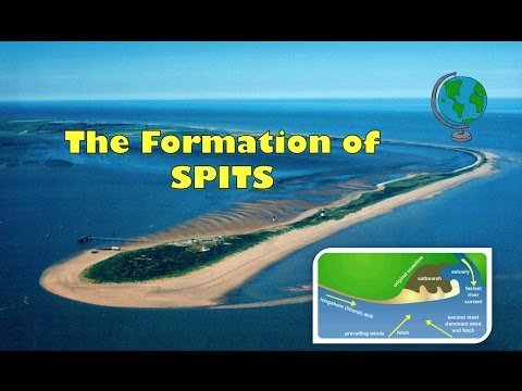
Geographer Online: how coastal spits are formed, with a labelled diagram. Watch for the change in coastline direction and the recurved end, and compare them with Figure 8.
Practice
Summary
Sources and credits
Photos: Spurn in 1979 (Stanley Howe, CC BY-SA 2.0); Slapton Sands From The Top Deck, Devon (Andrew, CC BY 2.0); Tombolo, St Ninian's Isle (Richard Webb, CC BY-SA 2.0); all via Wikimedia Commons.
Figures 8 and 9, the worked examples and the exercises were drawn and written by Ganzaa.
Video: "How Coastal Spits are formed - labelled diagram and explanation", Geographer Online, embedded from YouTube.
This lesson adapts CC BY-SA material and is shared under CC BY-SA 4.0.