Global Drainage Systems
Senior 6 · Geography
Global Drainage Systems
Lesson 5 of 5
25 min
The Namib Desert in Namibia runs right down to the Atlantic shore, and fog often hangs over its beaches. A desert next to an ocean seems strange until you meet the water: the Benguela Current flows north along the coast carrying cold water from the Southern Ocean, and cold water from the deep wells up beside the shore. Air over the cold sea is cooled from below, so it cannot rise to form rain clouds. The same current makes the sea off Namibia one of the richest fishing grounds in Africa. Ocean currents shape climates, fisheries and shipping routes across the world.
Definition
Ocean current: a continuous, directed movement of sea water. A warm current is warmer than the water around it, usually flowing from the tropics towards the poles; a cold current is colder, usually flowing towards the equator.
Gyre: a large ring of currents circling an ocean basin.
Coriolis effect: the apparent deflection of moving air and water caused by the Earth's rotation: to the right in the northern hemisphere and to the left in the southern hemisphere.
Upwelling: the rise of cold, nutrient-rich water from the deep to the surface, usually where winds push surface water away from a coast.
Thermohaline circulation: the slow, deep, global circulation driven by differences in water density, which depends on temperature (thermo) and salinity (haline).
Figure 1: an idealised ocean basin. Warm currents run poleward along the western side of each ocean (the east coasts of continents); cold currents run towards the equator along the eastern side (the west coasts of continents).
| Warm currents | Cold currents |
|---|---|
| Gulf Stream and North Atlantic Drift (Atlantic) | Canary Current (off north-west Africa) |
| Brazil Current (Atlantic) | Benguela Current (off south-west Africa) |
| Agulhas and Mozambique Currents (Indian Ocean, off south-east Africa) | Humboldt or Peru Current (off western South America) |
| Kuroshio Current (Pacific, off Japan) | California Current; Labrador Current (off north-east Canada) |
| Influence | Explanation and example |
|---|---|
| Temperature | The North Atlantic Drift keeps the coasts of north-west Europe mild in winter and the port of Murmansk in Arctic Russia free of ice |
| Rainfall and deserts | Warm currents add moisture and rain to coasts; cold currents chill and stabilise the air, helping to form coastal deserts: the Namib (Benguela) and the Atacama (Humboldt) |
| Fog | Where warm, moist air crosses cold water, or warm and cold currents meet, fog forms, as off Newfoundland |
| Fishing | Upwelling and the meeting of warm and cold water bring nutrients and plankton: the Peru anchoveta fishery, the Benguela fisheries and the Grand Banks of Newfoundland |
| Navigation | Ships save fuel by sailing with currents; cold currents carry icebergs into shipping lanes, like the Labrador Current that carried the iceberg struck by the Titanic in 1912 |
| Pollution | Gyres collect floating plastic, as in the "Great Pacific Garbage Patch" of the North Pacific |
Definition
Tide: the regular rise and fall of the sea surface, caused mainly by the gravitational pull of the Moon and, less strongly, of the Sun.
Tidal range: the difference in height between high water and the following low water.
Spring tide: a tide with an unusually large range, near new and full moon. Neap tide: a tide with an unusually small range, near the first and last quarter of the moon.
The Moon's gravity pulls the ocean on the side of the Earth facing it into a bulge. On the far side a second bulge forms, because the Moon pulls the solid Earth more strongly than the water farthest away, so that water is "left behind". As the Earth turns, a coast passes through both bulges, giving two high tides and two low tides in about 24 hours 50 minutes (a lunar day, longer than 24 hours because the Moon moves along its orbit). High tides are therefore about 12 hours 25 minutes apart, and each day's tides come about 50 minutes later. The Sun's pull is less than half the Moon's, but it strengthens or weakens the tide.
Figure 2: spring and neap tides. Each comes twice a month, about a week apart.
| Type | Pattern | Where |
|---|---|---|
| Semi-diurnal | Two high and two low tides of similar height each lunar day | Most Atlantic coasts, and the East African coast of the Indian Ocean |
| Diurnal | One high and one low tide each lunar day | Parts of the Gulf of Mexico and South-east Asia |
| Mixed | Two high and two low tides of unequal height | The Pacific coast of North America |
The shape of a coast changes the range a great deal. In the funnel-shaped Bay of Fundy in Canada, the range can reach about 16 m, the largest in the world; in the almost enclosed Mediterranean Sea it is usually only a few tens of centimetres.

Worked example 1: tide times and range
Problem. At a port with semi-diurnal tides, high water is at 06:10 with a height of 4.8 m, and the next low water is 0.6 m. Find the tidal range and estimate the time of the next two high waters.
Solution. Range . High tides are about 12 h 25 min apart:
The next day's morning high tide comes 50 minutes later than today's, as expected from the 24 h 50 min lunar day.
Worked example 2: the energy in a tide
Problem. A tidal barrage traps water over a basin of area with a tidal range . The potential energy released when the basin empties is , with sea-water density and . Find and the average power over one tidal cycle of 12.42 hours.
Solution.
Because energy rises with the square of the range, only places with very large ranges, such as La Rance in France or the Bay of Fundy, are worth developing for tidal power. Real stations convert only part of this theoretical energy.
| Threat | Example | Responses |
|---|---|---|
| Pollution: sewage, industrial waste, oil, plastic | Plastic collecting in ocean gyres; oil spills at sea | Treating sewage and factory waste; the MARPOL convention on pollution from ships; bans on single-use plastics, such as Rwanda's Law N° 17 of 2019 on plastic carry bags and single-use plastic items |
| Eutrophication | Fertiliser run-off causing algal blooms and "dead zones" without oxygen | Careful fertiliser use; buffer strips of vegetation along banks |
| Overfishing | Collapse of the Grand Banks cod fishery in the early 1990s | Quotas, closed seasons, minimum mesh sizes, marine protected areas |
| Invasive species | Water hyacinth choking parts of Lake Victoria in the 1990s | Mechanical removal and biological control with weevils that feed on the plant |
| Draining and over-use of water | The shrinking of the Aral Sea after its feeder rivers were diverted for irrigation from the 1960s | Efficient irrigation; protecting wetlands under the Ramsar Convention (1971); in Rwanda, protected buffer zones along rivers, lakes and wetlands |
| Climate change | Ocean warming, acidification, coral bleaching and sea-level rise | Cutting greenhouse-gas emissions (Unit 8) |
Oceans beyond national waters belong to no single country. Who should be responsible for protecting them, and how could rules be enforced?
Warning
Common mistakes
Tip
Memory hook. "West of the ocean is warm": the western side of each ocean basin carries warm water poleward. So east coasts of continents (Mozambique, Brazil, Japan) are washed by warm currents, and west coasts (Namibia, Peru, California) by cold ones.
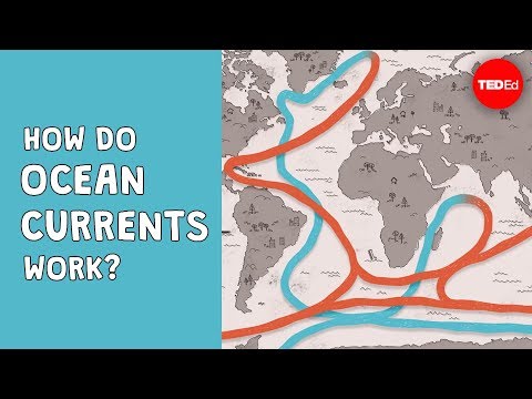
TED-Ed: "How do ocean currents work?" by Jennifer Verduin. Note the two kinds of circulation it describes, the wind-driven surface currents and the deep "global conveyor belt", and what drives each.
Practice
Summary
Further reading
Sources and credits
Photo: Halls Harbour low tide view (RobNS, public domain), via Wikimedia Commons.
Video: "How do ocean currents work?", TED-Ed, embedded from YouTube.
Figures 1 and 2, the worked examples and the exercises were drawn and written by Ganzaa.
This lesson adapts CC BY-SA material and is shared under CC BY-SA 4.0.