Forestry in Rwanda
Senior 4 · Geography
Forestry in Rwanda
Lesson 1 of 4
25 min
It depends who you ask. Figure 1 compares two official series for the same years.
Figure 1. Forest area of Rwanda according to the Government of Rwanda and to the FAO, 2011–2019. Drawn by Ganzaa from REMA (2021).
In 2019 the government's figure was more than two and a half times FAO's. Neither organisation made a mistake. The difference lies in what each one counts as a forest.
Definition
Forest (FAO): land of more than 0.5 ha with trees taller than 5 m and a canopy cover of more than 10%, not mainly used for farming or towns.
Forest (Rwanda): a group of trees 7 m tall or more, whose canopy may cover less than 10%, on land of 25 m² or more. It therefore includes small woodlots and trees outside large forests (REMA, 2021, citing the Ministry of Forestry and Mines, 2010).
Forestry: the science and business of planting, managing, protecting and using forests. Afforestation: planting trees where there was no forest; reforestation: replanting where forest was cut. Woodlot: a small plantation on a farm or community land.
Worked example 1: why do the two series differ?
Analysis.
Conclusion. Compare forest figures only when they use the same definition. Rwanda's own series shows a rise from 618,000 ha (2011) to 725,000 ha (2019); FAO's shows a slow rise from 266,000 to 275,000 ha. Both agree that cover increased.
| Type | Examples and area |
|---|---|
| Natural montane forest in national parks | Nyungwe (111,561 ha of forest), Volcanoes (16,000 ha), Gishwati-Mukura (4,520 ha) |
| Natural forest reserves | 107 reserves, such as Busaga, Buhanga, Sanza, Iwawa, Rubirizi and Makera: 37,886 ha |
| Savannah woodland and shrubland | Akagera National Park (113,160 ha) and unprotected woodland in the east (116,210 ha); 45% of Kayonza and 43% of Gatsibo are covered by savannah woodland |
| Plantations (public, district, private and institutional) | 387,425 ha in 2019 (53.5% of forest area); species mainly Eucalyptus, Pinus, Grevillea robusta, Acacia melanoxylon and Callitris |
| Agroforestry and woodlots | Trees on farms, along anti-erosion ditches and around homes |
Source: REMA (2021), Table 4-3 and text, from the Ministry of Environment's 2019 forest mapping.

| Province | Forest 2009 (ha) | Forest 2019 (ha) | Change |
|---|---|---|---|
| Eastern | 296,234 | 271,156 | −25,078 |
| Southern | 153,196 | 173,471 | +20,275 |
| Western | 146,145 | 169,364 | +23,219 |
| Northern | 66,529 | 81,691 | +15,162 |
| City of Kigali | 11,400 | 11,783 | +383 |
| Rwanda | 673,504 | 707,465 | +33,961 |
Source: REMA (2021), Table 4-1 (Ministry of Environment, 2019). Plots of 0.25 ha or less are left out so that 2009 and 2019 can be compared, which is why the 2019 total is lower than 724,694 ha.
Worked example 2: where is Rwanda's forest?
Interpretation. The Eastern Province holds almost two-fifths of Rwanda's forest, mostly savannah woodland, yet it was the only province to lose forest between 2009 and 2019. The west and south gained, largely through plantations. The national total rose by 5%, but the type and location of forest changed.

The Rwanda Forestry Authority (RFA) was established on 29 January 2020, under Law N° 72 of 2019, following the restructuring of the former Rwanda Water and Forestry Authority, to "ensure growth, management and preservation of forest resources for purposes of sustainable development". Its headquarters are at the Arboretum of Ruhande in Huye (RFA). Public forests are increasingly managed by private operators, and small private forests are being grouped into Private Forest Management Units (REMA, 2021; lesson 4).
Warning
Quote the definition with the figure. "Rwanda has 30.4% forest cover" (2019) uses the national definition and dry land as the denominator (unit 7). An FAO figure will be much lower. Writing "about 725,000 ha (Government of Rwanda, 2019)" is better than a bare percentage.
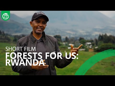
World Bank: "Forests for Us: Resilient Landscapes and Communities in Rwanda". How restored forests and woodlots support people and landscapes. Note which types of forest from the table appear in the film.
Practice
Key points
Sources and credits
Sources: Rwanda State of Environment and Outlook Report 2021, REMA (forest definitions, FAO and national series, forest types and areas, province table, species); Rwanda State of Environment and Outlook Report, REMA, 2009 (2007 inventory); About RFA: Background, Rwanda Forestry Authority.
Figure 1 and the worked examples were drawn and written by Ganzaa.
Photos: Gishwati Natural Forest 02, Andr96, CC BY-SA 4.0; ArboretumForest, 200 hectares forest planted located in Uni Rwanda HuyeDistrict, Jeanmukundente, CC BY-SA 4.0; via Wikimedia Commons.
Video: "Forests for Us: Resilient Landscapes and Communities in Rwanda", World Bank Group, embedded from YouTube. The rest of the lesson and the exercises were written by Ganzaa.
This lesson adapts CC BY-SA material and is shared under CC BY-SA 4.0.
Quick check
Why does FAO report much less forest for Rwanda than the government does?